I agree to and consent to receive news, updates, and other communications by way of commercial electronic messages (including email) from Tectonic metals. I understand I may withdraw consent at any time by clicking the unsubscribe link contained in all emails from Tectonic metals.
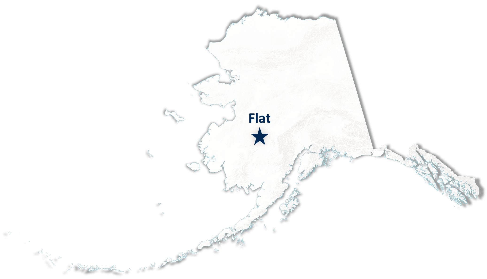
Flat
The Flat Gold Project is located in Southwest Alaska, covering 99,840 acres of predominantly Native-owned land belonging to Doyon Limited, Tectonic’s second-largest shareholder and one of Alaska’s largest for-profit Native Regional Corporations. Flat hosts a bulk-tonnage, Reduced Intrusion-Related Gold System (RIRGS) analogous to the Fort Knox gold mine.
Recognized as a prime example of the direct relationship between placer gold and bedrock sources, placer gold shed from Flat’s intrusions have contributed to 1.4 Moz1 of placer gold production. Notably, the Project has achieved a 100% drill success rate, with gold intersected in all 191 drill holes, covering 3.3 km of drilled mineralized strike and reaching a vertical depth of 400 m at its primary intrusion target, Chicken Mountain, with mineralization remaining open in all directions.2
Flat Gold Project – Highlights
1.4 Moz1 Historic Placer Gold Production
Mined from creeks draining the Flat Project area
Chicken Mountain target credited as the primary bedrock source
20 km “String of Pearls”
Six geophysical anomalies that indicate a potential gold deposit
6 District Scale Intrusion Targets
Each km-scale target has the potential to be a stand-alone gold project
Located Adjacent to One of the World's Largest Undeveloped Gold Deposits
40 KM NE of Donlin Gold Project (+39Moz3 Au)
Chicken Mountain Intrusion Target – Highlights
3.3 KM Drilled Mineralized Strike
Open in all directions
100% Drill Success Rate
191/191 drill holes intercepted gold
Soil sampling + geophysics: a proven exploration methodology with a 100% drill success rate to date
61% Drill Holes Ended in Gold
Deepest hole = 423 metres long
4 km High-Tenor Gold in Soil Anomaly
Unglaciated terrain
Non-transported soils represent underlying bedrock
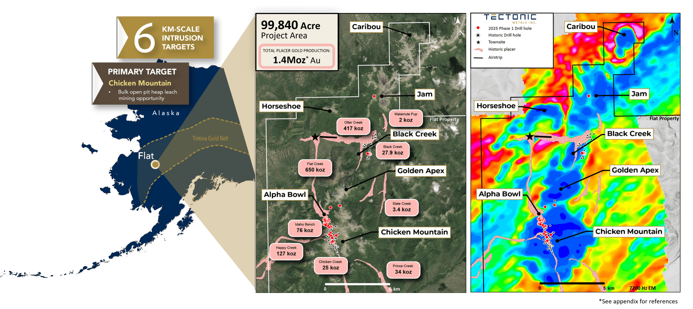
Figure. The Flat Gold System within a 20 km “string-of-pearls” geophysical trend.
(Right) Satellite plan view of the Flat Project with a 7,200 Hz geophysical survey overlay, highlighting six km-scale volcanic intrusion targets. Drill confirmed intrusions include: Chicken Mountain, Golden Apex, and Black Creek, while Jam, Horseshoe, and Caribou represent potential new discoveries. Jam has been drilled for the first time during the 2025 Phase 1 drill program and is pending assay results.
(Left) A complementary satellite map. Both maps display historic placer-producing creeks (pink), that have collectively yielded 1.4 Moz1 of gold interpreted to drain from Flat’s intrusions. Chicken Mountain is credited as the primary bedrock source.
REFERENCES
- Placer production figures from “Mineral Occurrence and Development Potential Report,Locatable and Salable Minerals, Bering Sea-Western Interior Resource Management Plan, BLM Alaska Technical Report 60”, prepared by the U.S. Department of the Interior, Bureau of Land Management, November 2010.
- Tectonic Metals Ltd. (2025, May). Tectonic Metals corporate presentation: The Flat Gold Project, Alaska's next tier one gold mining opportunity [Slide 25].
- Donlin 2021 NI 43-101 Technical Report. Tonnage: 541,337kt at 2.24g/t Au. Measured & Indicated: 39,007koz Au. Assuming an average recovery of 89.5% and average 5% grade of 1.07, the marginal gold cut-off grade is 0.47 g/t. Gold price of $1,200/oz is assumed